
The now notorious (infamous) UK heatwave that happened a few weeks back will definitely go down in history. Not least because if the controversy surrounding it. And it looks there’ll be a warming of the UK’s weather once again during the coming days.
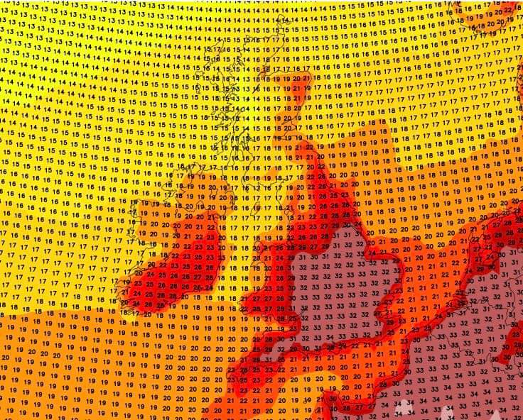
As it stands there are currently a few options on the table. Being so far in advance means nothing’s set in stone. Although forecasting models are now starting to align so the signals for an August heatwave are definitely there. You can see a recent GFS output focused on next week below.
The jury’s definitely out about thermometer readings climbing to 40C. But it could happen – nothing’s being ruled out. So it’s a case of watch and see. Here’s what our friends at Real Weather are saying.
‘Following my previous post regarding heat building into next week. It all depends on the positioning and orientation of high pressure from the southwest initially.
Whilst reaching the intense highs of 40c is less likely the attached chart shows maximum temperatures for next Tuesday/Wednesday before the model output goes on to show 40c later in the week.

A few options are on the table at the moment. The first is a slow build up to some heat with the high twenties to low thirties being the maximums next week with a gradual decline from the northwest as lows attack from the northwest.
Another option is a slow build up to heat and like the above scenario widely the high twenties to low thirties for England and Wales. Fresher in the far northwest but later in the week a push to much hotter temperatures as a plume moves out of the near continent. Perhaps with a thundery breakdown.
The least likely option is a few days of the high twenties to low thirties before low pressure completely takes over.
So there are options on the table. Monday and Tuesday are the key dates if you’re model watching. Things to keep an eye on is the high pressure from the southwest, it’s more of a ridge attempt showing on the models.
Also keep an eye to the northwest with regards to low pressure systems. We ideally want the high pushing the lows as far north possible for a decent attempt at some established heat and generally settled conditions.
The temperate chart that showed 40c in the 06z output is what COULD happen if everything sets up favourably.’
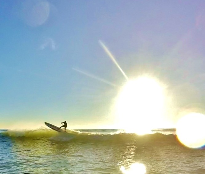
With school summer holidays in motion many will be away on a break. Perhaps at the coast. This should make any warm weather more bearable. There’s nothing like a sea breeze to temper things.
Hopefully the heat won’t reach dangerous levels. Instead, delivering a pleasant period of proper summer conditions that you can take full advantage of.
Don’t forget. For all your summer watersports and outdoor adventure needs NCW is your one stop shop. Get in touch with any questions.